Experts debunk myths that Marianas Trench, reef would shield Marianas from tsunamis
Rather than protect the Marianas from tsunamis, both the Mariana Trench and the Saipan Lagoon reef actually intensify seismic waves, according to Dr. Kwok Fai Cheung, a distinguished professor of ocean and resources engineering at the University of Hawaii.
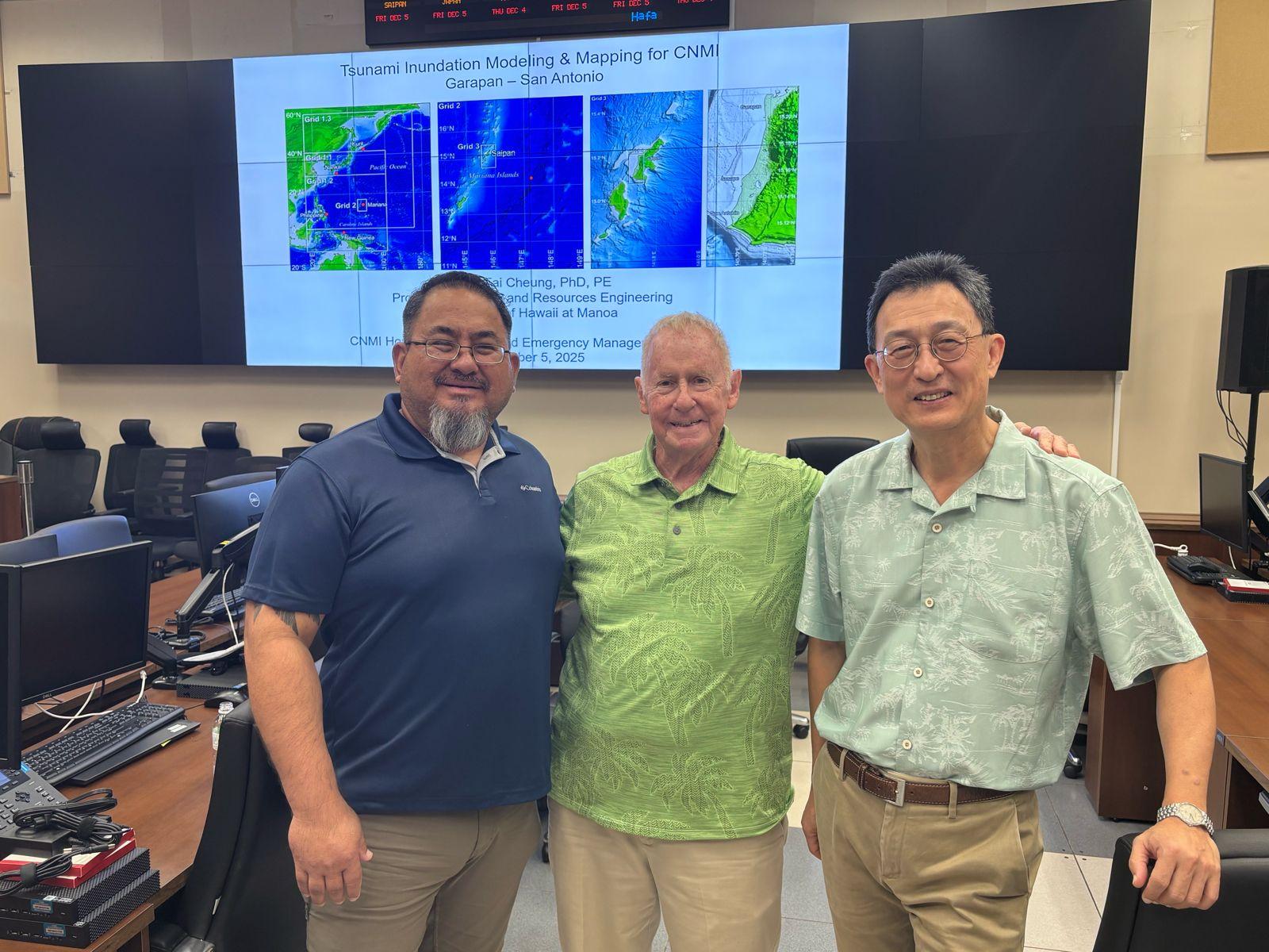
“The Mariana Trench kind of makes a tsunami more severe for the islands because the tsunami is generated near the deeper part of the trench. As a tsunami propagates toward the island, the energy gets compressed, and the wave height increases,” Cheung told the media during a Tsunami Information Presentation last Dec. 5 at the CNMI Homeland Security and Emergency Management Emergency Operations Center on Capitol Hill.
Cheung, accompanied by Chip Guard of Tropical Weather Sciences, said that if a strong earthquake—magnitude 8.3 or higher—occurs near the trench, a tsunami up to 50 feet high could strike Saipan, Tinian, Rota, and the Northern Islands.
For residents living in coastal areas, Cheung noted that Saipan’s west coast—the tourist hub of Garapan and the school-lined stretch along Beach Road—could be more susceptible to inundation.
“On the east side, because of the cliffs and higher elevation, you might have some protection. But on the west side, the slope is more gentle and flat. A tsunami would reach the area within maybe 10-15 minutes,” he said.
Both Cheung and Guard stressed that if a strong local earthquake occurs, residents must act immediately.
“Don’t wait for instructions. If there’s an earthquake strong enough that you cannot stand still and it lasts for about half a minute, then go inland right after. Go to higher ground—more than 50 feet to be conservative,” they said.
Cheung added that the Saipan Lagoon reef only protects the island from typhoon-generated waves.
“It’s common for the public—and even some tsunami scientists—to think the reef would protect the community. But it’s the opposite. The reef protects from hurricane waves because their period is about 12 seconds, allowing the wave to overturn and dissipate energy. But a tsunami has a period of 10-15 minutes. That’s like a fast-moving river for 15 minutes. The reef directs the flow upward and amplifies the energy,” he explained.
The island’s thin strip of mangroves near the Gov. Eloy S. Inos Peace Park also offers little protection, Cheung said, noting that Saipan would need extensive mangrove coverage for it to be effective during a tsunami.
Guard underscored the two biggest misconceptions: “Myth No. 1 is that the Marianas Trench is going to eat the energy. It actually generates the most dangerous earthquakes. Myth No. 2 is that coral reefs will protect you. They help dissipate hurricane waves, but for tsunamis, they can make waves higher.”
He noted that these myths were already disproven in 2009 when a tsunami killed 34 people in American Samoa and 159 in independent Samoa.
During the over hour-long presentation, Cheung—contracted under the National Tsunami Hazard Mitigation Program—unveiled new inundation models showing significantly higher risk for Saipan’s west coast, particularly Garapan to San Antonio, than previously projected in decade-old federal evacuation maps.
Updated one-meter LIDAR data and new “credible worst-case” earthquake scenarios show that both local and distant tsunamis could send water well past Beach Road and into Lake Susupe, with flow depths of 10-20 feet in parts of Garapan.
Cheung warned that old NOAA maps—based on an arbitrary magnitude-9 scenario and lower-resolution elevation data—underestimate inundation, even showing the Mariana Beach Resort outside the hazard zone when new models show it would flood.
He urged HSEM to update its evacuation maps, noting that FEMA’s National Risk Index—tied to federal mitigation funding—relies on accurate exposure data.
The briefing highlighted two major threats:
Local tsunami (Mariana Trench, magnitude 8.3-8.5)
Travel time: 10-15 minutes
No practical warning: residents must self-evacuate immediately after strong shaking lasting 20 seconds or more
Expected to produce the largest inundation on Saipan’s west coast
Distant tsunami (Nankai Trough, Japan, likely magnitude 8.7)
Travel time: 2.5-3 hours, with public alert potentially delayed by 30 minutes
First waves relatively small; more destructive waves about an hour later
Amplified by Saipan’s broad west-side shelf
Japan assigns a 60-94% probability of a full-rupture event within 30 years
Cheung reiterated that Saipan’s shallow western shelf amplifies tsunami energy, focusing waves onto the island’s semicircular coastline.
Concerns were raised about multiple public schools in the inundation zone. Saipan Mayor’s Office compliance officer Ray Dela Cruz acknowledged that there would not be enough time to move hundreds of students uphill during a local event and urged the development of vertical evacuation plans with nearby hotels and multi-story buildings.
The FY24 modeling covers Garapan to San Antonio. FY25 work will expand to the harbor area, north to Puerto Rico, and include maritime hazard maps detailing surge and current impacts on vessels.
At the close of the event, HSEM special adviser Clement R. Bermudez emphasized the need for community education, more sirens, and aggressive correction of misinformation.
“It’s not to scare people but to accurately inform them,” he said. “If it’s a local tsunami, we’ve got less than 10 minutes to get out of that pavilion if you’re at Minatchom Atdao [Pavillion]. If it’s a distant one, well, that’s probably another case of beer you can finish before heading to high ground.”
Share this article